
 We headed north from Morganton on Highway 181 with plans for several shorter stops rather then a full day on one trail. The first short stop was to enjoy the view at the Brown Mountain overlook. If you like natural mysteries this is a place to stop at night and look for the Brown Mountain lights. A very nice view during the day also with Brown Mountain in front of you and Table Rock behind. The next short stop was to find a geocache at the Barkhouse picnic area. We parked outside the gate and walked through the picnic area and a short way down a trail where we located the cache. The sign said the picnic area was closed for the winter but it looked pretty rough and the bathroom door was screwed shut. I am not sure this area will open this year. We made another quick stop just up the road on the right to climb around a large rock looking for a geocache that we did not find. Continuing up the road we looked for the entrance to the parking for the upper and lower creek falls trail. When we reached Gingercake Acres Road we knew we had missed it and turned back. Both of the signs for this area are missing but you can see where they were. There was only one car in the parking area when we arrived but there were a half dozen when we were leaving.
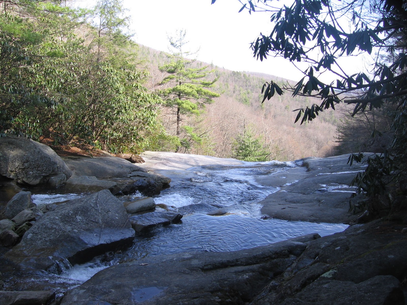 Our plan was to make a loop hiking down the Upper Creek Falls trail and back up the Lower Creek Falls trail. This would be a 1.6 mile hike. The Upper Creek trail start out as a fairly level woods walk with rocks and roots in the trail. We could hear the traffic on 181 as we walked parallel to it but it was mostly out of sight. It seems like we hear a crow on every trail that we walk and this was no exception. Soon we were hearing the sounds of running water. After the first switchback the trail got steeper and a short ways down we got out first glimpses of the stream. We made one more turn and arrived at a short staircase leading down to the creek. At this point we were just above the falls and would have to rock hop across the creek. A family group was just finishing packing from a day of camping at the site directly across the creek as we arrived. We watched them cross and enjoyed the views before making our way across. Once across the creek we walked through the campsite and continued down the trail. This section was quite level and allowed glimpses of the falls through the trees. We wondered if this was all we would see of the falls but a little ways down we found a switchback that brought us back to the falls at a lower level.
  The first viewpoint is straight ahead of the trail. Here there are several rocks that the falls can be viewed from. The trail to continue downhill is back about twenty feet. A short ways down is another campsite. We walked through it to get more views of the falls. The last campers must have thought there was trash pickup here as they had left behind a garbage bag that the local critters had visited. This would be a really nice spot to spend the night listening to the sounds of the waterfall. Continuing down the trail we soon reached the lower falls area and a second creek crossing point.
  I decided that the water was too high for me to attempt a rock hop here. Mitch spotted a log slightly downstream and suggested we scoot across it. He made it across but I got halfway and got stuck. I was fine where the log was smooth and slightly downhill but then it became slightly uphill with a large knot. I would scoot forward an inch and slide back. This was embarrasing especially after another groups of hikers arrived. It began to look like I was spending the day suspended over the creek. Finally I scooted back the way I came and we backtracked up the trail. Sometimes it just isn't worth taking the chance of getting hurt on the wet rocks.
Our last stop of the day was hawksbill. We had viewed this rock with it's unique shape many times from the Blue Ridge Parkway but this time we would check out the views from the top of the rock. We drove up 181 to Gingercake Acres and followed the signs for Table Rock Picnic Area. The trailhead is several miles out on this gravel road but before you are close to Table Rock. There were cars parked before and after the trail head parking area. This hike is only 1.5 miles round trip but there is a 700 foot elevation gain. The trail is narrow and rough with lots of rocks and erosion. It looks like it turns into a stream when it rains.

At about a half mile the trail leveled out and for a short while it was an easy woods walk. Just as the trail went slightly downhill and right before the intersection with the Jonas Ridge trail we made a left turn and the trail became steeper. I was glad we only had a quarter mile to go. Mitch spotted a big rock on the left that was split into what almost looked like blocks. One day this rock will roll down the mountain. Just before the peak the trail splits for a hundred feet of so. We chose straight ahead which is steeper going up and came down the slightly longer and easier trail. We had passed many hikers on the way up but there were only two groups at the top while we were there.
 The views at the top are worth the effort of getting there. If you turn left for a hundred feet or so at the top of the last scramble there are excellent views of Table Rock. To the right are lots of rocks to walk around on and views in all directions. You can see row after row of mountains and down below you can see the Linville River winding through the gorge. Looking across at the cliffs on the far side of the gorge it is hard to see how there are trails on that side down to the river but we know they are there. Maybe one day we will hike on that side but for today we will enjoy the views and head for home.

No comments:
Post a Comment