Sunday, July 10, 2011

Stone Mountain Loop Trail 7/8/2011

This hike is in Stone Mountain State Park in North Carolina not the other stone mountain.  As we entered the empty upper trail head parking lot there was a deer grazing nearby.  There are restrooms and a soda machine available here.  We followed a family of wild turkeys on the .3 mile connector trail.  There are advantages to being first to the trail head.  Later in the morning the trail got busier.

The connector trail ends by an old chimney.  We turned right here toward the upper half of the loop.  The trail here is wide and smooth like a road with no steps all the way to the top.  I imagine emergency vehicles can access the top from this side.  We went through woods with a few flowers and lots of mushrooms.  We heard a turkey calling and a crow complaining.  

The trail passes an outcrop of granite with a good view then returns to the woods before a second outcrop section.  At this point we had a view of the peak ahead as well as what I believe was Wolf Rock to the left.  There are warning signs along the way to stay on the trail as the rock can be slippery and suddenly becomes very steep as it drop off the side of the mountain.

After this second outcrop area the trail drops into a very small saddle before climbing more steeply with a couple of switchbacks.  A black snake crossed the trail and curled up on the fence waiting for us and another hiker to take our pictures and move away.  The trail levels out more and a short time later at 1.7 miles from the parking lot we reached the peak.

The peak area was full of potholes but the rock surface was smooth.  The signs said the elevation was 3205 feet and we were 1.6 miles from the Hutchinson Homestead.  We enjoyed the views including the parkway in the distance then headed along the ridge through more wooded areas and outcrops to where the serious drop began.

As we reached the end of the ridge area there was a wire handrail for the last hundred feet of so  to the top of the stairs.   I noticed that the trees here are short but very green and healthy looking.  They appear to be growing out of the rocks.  No longer is the trail like a road.  From here we began a serious descent.  There were wooden stairs and rock stairs with sections of dirt trail inbetween. 

At the bottom of this section we crossed the handicap only road to the homestead and began a gentle walk on a more natural trail.  The trail passes very near the lower parking lot with restroom and a water vending machine.  It then follows a pretty little stream for a half mile to the homestead.  The rhododendrons were in bloom along this section.

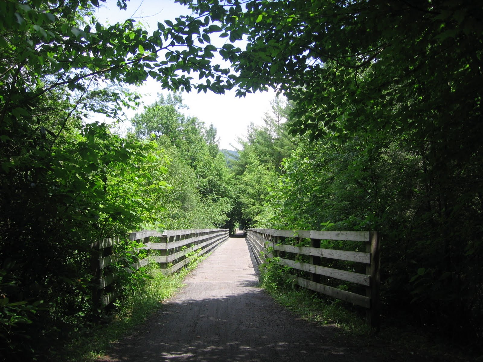
The Hutchinson Homestead was a house and several outbuildings  The buildings are only open on the weekend.  There is a bridge to cross from the trail to the house.  The mountain is right in front of you here with a clear view.  There are several benchs in the field area facing the big rock.  If you follow the road through the homestead you come back out on the trail.

Beyond the homestead the trail is once again more like an old road following a small creek.  We could hear a woodpecker on the hill to the left and see minnow in the creek on our right.  There were foot bridges over the water although we chose to follow the road and step across the creek at the ford in a couple of places.  About a mile down we came to the trail down to middle and lower falls.

It is a half mile down to middle falls and a mile down to the lower falls.  The road like trail actually turns down this way.  Before middle falls we left the wide trail at a sign  and went down a steep rooted trail to the falls.  They are a steep slide with a pool at the bottom that are pretty but hard to photograph.  To reach lower falls you would return to the intersection and continue downhill but we headed back up.

Back on the loop trail we were now following a larger creek with lots of pretty cascades along the way.  The trail is again narrower and more natural.  The air temperature was pleasant for a hot summer day.  This part of the trail was busier with people enjoying the water.  It wasn't long before we reached the steps leading to the bottom of Stone Mountain Falls. 

The falls are 200 feet high but didn't have a lot of water falling.  They must really be impressive during the Spring melt.  There were several groups of people enjoying the rocks and water at the bottom of the falls.  There is room to climb around and take pictures from different angles if you are careful.  We are almost finished with the 4.5 mile loop at this point but have 200 plus feet of elevation to gain.

We climbed a couple hundred wood steps then  and took a break at the upper overlook looking down over the main section of the falls.  You had to stay on the platform here as it is a long first step from here.  There were still more steps and a steep walk up the rock slab beside a railing to go.  Once at the top the connector trail was right around the corner.

We walked about six miles today but there are many more miles of trails in this park.  Perhaps we will return to explore some of the less traveled trails.  The loop trail is child friendly and there is a nice picnic area in the park.  One other spot we did visit in the park was Widow's Creek Falls.  It is a pretty falls only a couple hundred feet off the park road with places where you can play in the water.

Saturday, July 9, 2011

Tubing on the New River 7/7/2011

I realize this is a hiking blog.  But this week we decided to try a couple of different adventures.  The New River Campground where we were staying offered tube rental and a ride three miles upriver.  They are located between Sparta, NC and Independence, Va right on the state line.  We put the tubes in the water at a long one lane bridge.  Our group scared a water snake out of the grass where we waded in.

Once in our tubes we made our way slowly downstream.  It took three hours to float three miles.  The river is wide, shallow, not too cold and the color of chocolate.  We tied our two tubes together with bungee cords and took turns pulling each other off the rocks just below the surface.  Mostly this was a very relaxed  ride where progress was very slow.

We saw cows cooling off near the edge of the river in a couple of different spots as we passed farms.  We watched an osprey perched high in a dead tree take off up the river to hunt.  The class I and class II rapids that we expected turned out to be a few places where we got caught on rocks and then bounced down a foot of so for a cooling splash.  They were tamer then the lazy rivers at water parks.

There was an island in the river near the end of the float.  We went to the left and ended up almost at a stand still.  The main current went to the right side.  There had been thunder in the distance and now we were getting rained on.  But the sun came out a few minutes later and we were having a good time again as we approached the landing.

Virginia Creeper Trail 7/6/2011

The Virginia Creeper Trail is a 33.4 mile shared use trail  that was once a railroad line.  We chose to bicycle the upper 17 mile section renting bikes in Damascus.  The shuttle ride to Whitetop Station took about thirty minutes.  Even on a weekday there were several vans unloading when we arrived at the trailhead.  This must be a very busy trail on the weekend.

This trail is constantly downhill.  I spent more time braking then peddling although the trail was never steep.  The first few miles are through woods with some rock cuts.  The trail is mostly wide and smooth but it is a natural surface so there are some small bumps and ruts along the way.  About three miles down is the Green Cove Station with a combination old general store and restrooms. 

Portions of this trail are through Jefferson National Forest and Mt. Rogers National Recreation Area but parts of it are through private property.  We traveled through wooded areas along Laurel Creek and past rural residential areas.   There were many places to stop by the creek.   About seven miles down we passed the Creek junction trail head with parking and restrooms.

About twelve miles into the ride we arrived in Taylor's Valley.  There was a roadside stand advertising the lowest prices for lunch on the trail but we continued on a short distance to the Virginia Creeper Cafe where we ate lunch at a table in an air conditioned restaurant.  I should mention that the wooded nature of the trail kept the temperature comfortable even on this hot summer day.

There are many trestles along the trail but none of them are extremely high or offer vistas of the mountains.  The views are of the valleys, woods, and streams.  The ride is very pretty and relaxing.   The people we along the trail were all polite and friendly.  We encountered construction at one of the trestles and had to walk our bikes across. 

A few miles from the end of the ride we passed  small but pretty Whitetop Laurel Falls.   As we were looking for the nearby geocache a ranger on a bike cautioned us that a copperhead was spotted nearby.  Beyond here the trail levels out and we had to pedal continuously for the first time.  Just as we passed the entering Damascus sign we got sprinkled on for a few minutes.

This trail was a lot of fun and not a lot of effort.  There were many children enjoying the trail on their own bikes or riding behind their parents.  We definitely want to return here. 

Blue Ridge Parkway including E B Jeffress 7/4/2011

We entered the Blue Ridge Parkway in the Linville area and headed north.  Our goal was to spend time in the area north of Blowing Rock that we had not visited before on our way to New River Campground at the North Carolina Virginia border.  I noticed that the rhododendrons and mountain laurel were in bloom in this area even though they bloomed weeks ago in the higher elevations south of here.

We passed by Linville Falls but made a short stop to enjoy the view at Price Lake.  There is a nice trail around this lake and canoes available for rent.  We also passed by the Linn Cove Viaduct, Grandfather Mountain, and Moses Cone.  We have spent many days enjoying this area but are headed further north today.  Look for future blog entries for this area.

Our next stop was at a clearing where two building stand.  We could have parked at the overlook five hundred feet before the clearing or at E B Jeffress a half mile further north and walked the Mountain to Sea Trail to the clearing.  Cool Spring Baptist Church met in this clearing when the circuit riding preacher was in town.

 
Preaching was held in the shade of a big tree.The above building was not a church but a bad weather shelter.  Also in this clearing is the cabin owned by Jesse Brown that the preacher would stay in overnight.  Neither building had a wood floor and there were large gaps in the boards that would once have been filled with mud.

Our next stop was at E B Jeffress.  There are restrooms and picnic tables near the parking lot.  The Cascade Trail is a pleasant thirty minute loop hike.  Just past the restrooms the trail forks and we took the right side.  The trail gently descends through the woods to a bridge crossing Falls Creek. 

After crossing the bridge a right turn leads to the falls and the return trail is to the left.  There are stairs leading down to the first overlook below the top cascade but above the longer falls.  You can look down from here at the falls and see the lower overlook.  To get there you move back from the creek and descend more steps.

At the lower overlook we heard a distinct crashing sound every few seconds as the water hit one particular spot.  We could tell that the water continues to cascade below where we could see.  This was a busy trail with many people enjoying the holiday.  Returning to the intersection the trail follows the creek upstream.

As we approached the second bridge I thought about how amazing it is that such a small creek can create such a pretty waterfall.  The trail continues to follow the creek through a pretty woods with rhododendrons and mountain laurel blooming.  You can see and hear the traffic on the parkway but you could hear the creek babbling between the cars.

Our next stop was at The Lump overlook.  There was a good view from the parking area but we wanted to go to the top.  You can't tell from the picture but there were flowers along the sides of the trail.  The flowers at the top were different from the ones on the way up and just beyond the peak were lots of blackberry bushes that weren't quite ready for picking.

Our last walk for the day was at Jumpin' Off Rock.  This is a half mile each way walk in the woods  on a well graded trail.  The walk is uphill then level then uphill again but never steep.  The last section is level or slightly downhill.  The Mountain to Sea Trail exits on the right a couple hundred feet before the overlook.  The overlook appears to have covered the rock as there  was no rock in sight.