


 On the way back from the falls I spotted this one flower blooming beside the trail. It was about the size of a violet and on first glance I thought that was what it was. When I moved in closer to take the picture I realized it wasn't a violet. Does anyone recognize this flower?
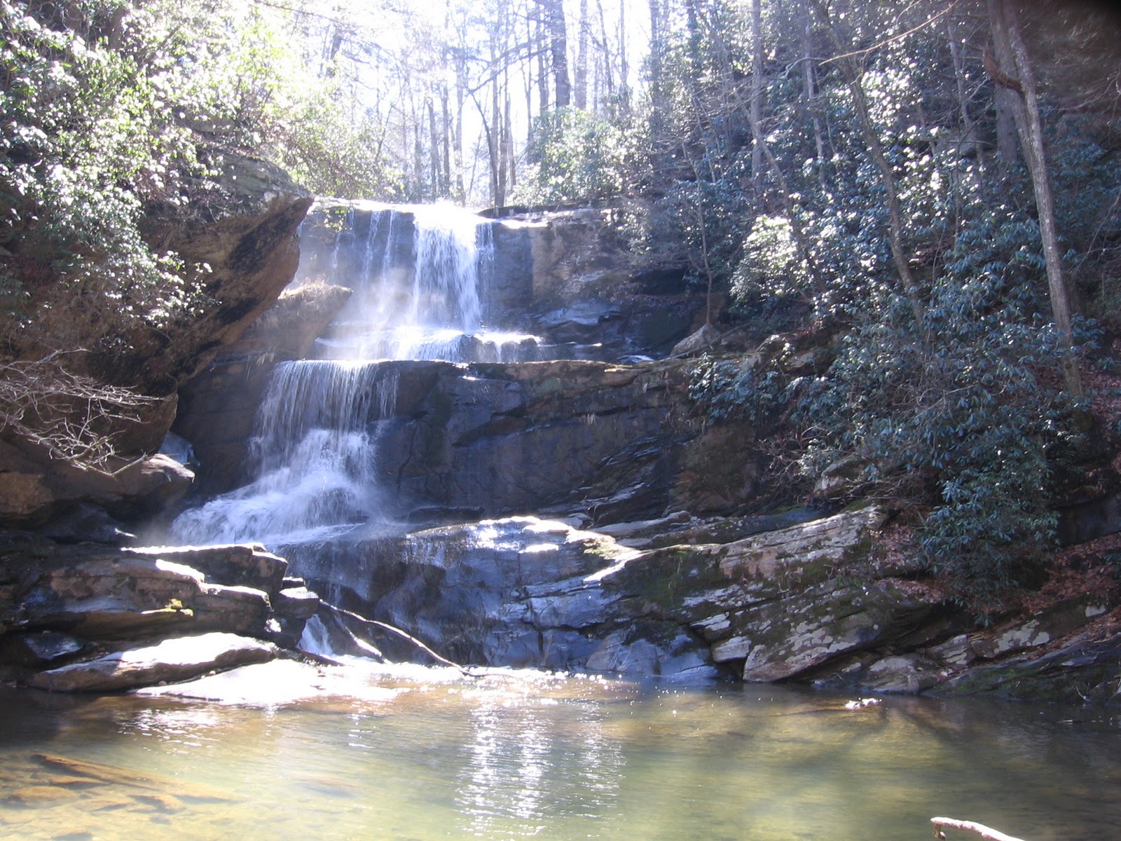
After returning to the van and repacking the backpack with lunch we took the trail past the orange gate and through a field. There was a fork in the trail and we chose the right side. It led through more of the field then up a short hill. We discovered on the way back that the left side entered the woods and followed the edge of the field to where the other trail joined it. After a short walk in the woods we reached the creek crossing. There was a small waterfall here and a geocache to find. After looking at some rocks that would require hopping we crossed a shallow area getting our feet wet and continued up the trail.

It a few minutes we could hear the falls but could not see them. We had read that one of the side trails on the left led down to the the base of the falls. It is a very steep trail and requires using a rope to get down a rock face. We decided to continue to the geocache that was about a half mile past the falls at the top of the hill and then look for views of the falls. We passed a total of four side trails and decided to try the third one on our way back. There was nice mountain view just before this trail started downhill. Perhaps another day we will investigate where this trail leads.

We went back past the highest side trail and took the next one down. Straight down there was a large rock at the edge of the gorge that you could climb down to. There was a view of the falls here partially blocked by a tree. A false step would have meant a vertical drop of several hundred feet into the gorge. There are no guardrails or fences anywhere in this area. Climbing back up from this ledge we took a right turn and followed the narrow side trail along the edge of the hill to another view of the falls. This view was not blocked by a tree but was at a different angle and didn't seem to show the full height of the falls. Continuing on we realized that this side trail came back out on the main trail at what had been the second side trail that we passed.

We returned back to the creek crossing area and found a big rock to have our picnic on. This trail was busier then the Little Bradley Falls trail so we watched several groups cross the creek as we relaxed. The young groups easily rock hopped across the stream while the mature hikers chose to cross upstream where several trees had fallen. We saw one group sit on the logs and scoot across and another group walk across on the lower logs while steadying themselves on the upper logs. I ended up using a combination of both and didn't get wet feet this time. I would bring the Grandchildren to this spot to play in the water but would not take them to the overlooks for the falls.
We enjoyed both of these falls but if you only have time for one I would recommend Little Bradley Falls. The trail was more interesting and the pretty falls were much more accessible. If you are looking for an extreme adventure then Big Bradley Falls in the trail for you.
No comments:
Post a Comment