From the community of Linville Falls at the Blue Ridge Parkway we took 183 to Kistler Memorial Highway. Our first stop on this cool, cloudy morning was the Linville Gorge Cabin. Inside we had a nice conversation with the ladies working at the cabin about our planned hike, assuring them we were properly prepared. I signed the guest book and promised to stop by on the way out to show them my pictures.
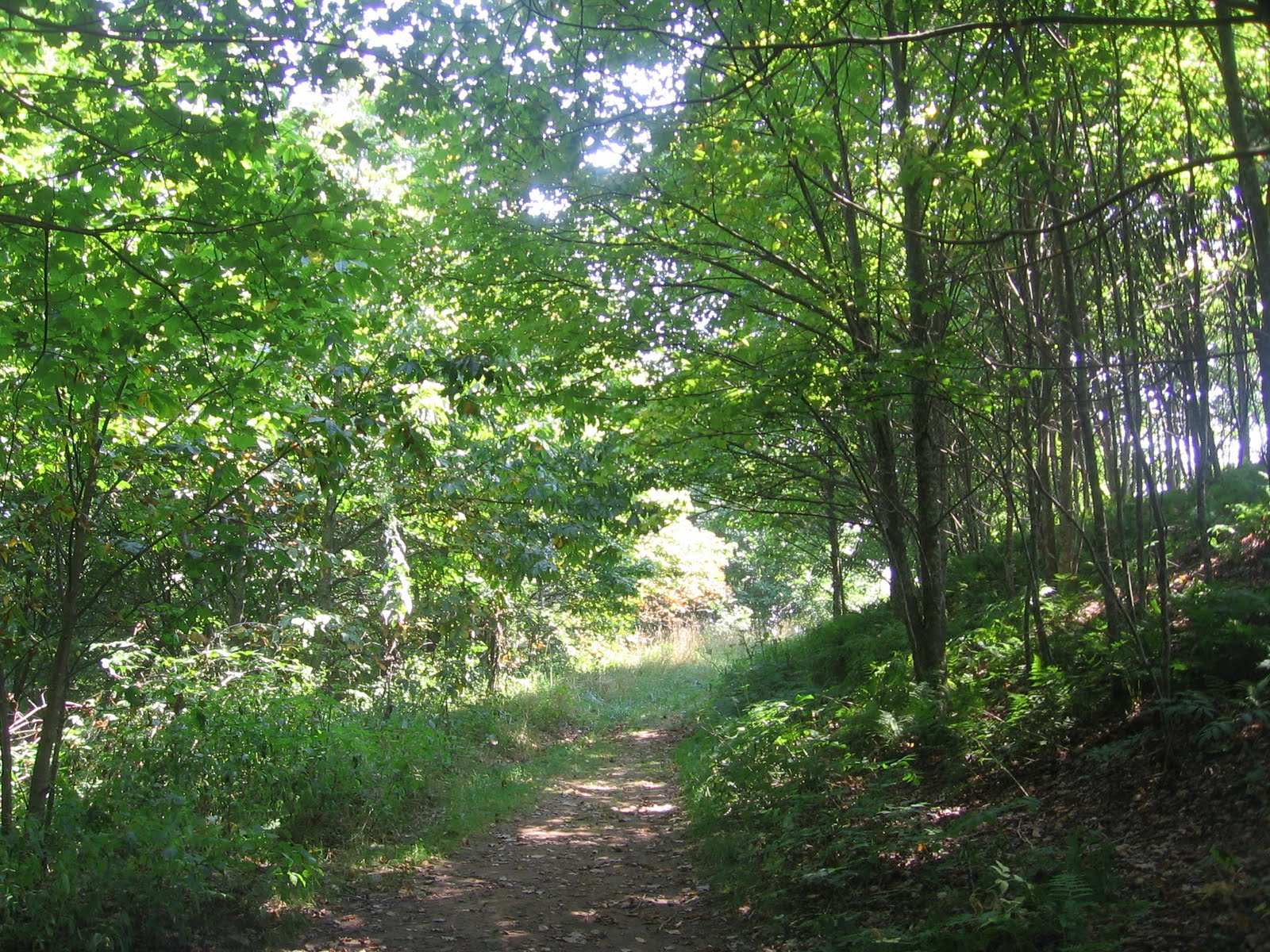
From here it was a short drive on the gravel highway to the trail head. The Pine Gap trail follows the end of the ridge quickly dropping toward the river level. It is narrow and alternates short almost flat sections with steep areas with lots of obstacles. The ground was damp and there was lots of moss on the rocks and fallen trees. The nearby mountain peaks were shrouded in clouds.
We had been hearing the river below up since we started the trail. In less then a mile we reached the level of the river and took a very short side trail to the river's edge. There were a couple of campsites here and a nice area to enjoy the river and the flowers growing near the water. We were further downstream from the falls here then at the trail head and the water was quieter.
From here the trail climbs away from the river again for a time and passes the point where the Bynum Bluff trail climbs out of the gorge. This is a wilderness area and there was only a small sign at the intersection. Beyond this point we came to an area where we could hear the river on both sides of us. The trail was right beside the river for a time but it was about a hundred feet below us.
We came to what looked like a fork in the trail. To the right the trail appeared to stop in about fifty feet. Later we decided that the trail was just overgrown and we should have pushed on till it was clearer again. Instead we turned left and walked down to the river. This appeared to be the spot where the Brushy Ridge trail fords the river. There were several campsites here and a small waterfall.
We walked downstream from this point staying beside the river for about half a mile. With no clear trail here we walked on all sizes of rocks including some that sloped down to the water. In places we climbed a short distance up the steep bank. We stopped when we approached a sharp turn in the river where we couldn't see a way to proceed and ate lunch on a big rock.
After lunch we backtracked to the intersection of the Bynum Bluff trail and began to climb out of the gorge. This trail was less technically difficult then the Pine Gap trail but was steeper overall and gained more elevation. For a time the trail climbed gently and we thought we were near the top. It turned out the last part of the climb was the steepest, switch backing past tall rocks.
When we did reach the top we were rewarded with a pleasant level walk along a narrow ridge. There were some nice primitive campsites along this section and views of the mountains obscured by clouds across the gorge and the river below. The trail ended at Kistler Memorial Highway and we walked downhill on the gravel road back to the van.
We hiked a total of about four or five miles in five hours, spending a lot of time enjoying the river and the peacefulness of the gorge. We encountered about five small groups of hikers the entire time. This is a wilderness area and needs to be respected as such. There are steep drop offs along the trail that could lead to disaster. But with proper care this is a very special spot.
We get out about once a week to hike usually in central to western North Carolina. We hike slowly and stop often to enjoy the views and the little treasures that nature offers. We enjoy waterfall, river, and mountain hikes frequently visiting The Blue Ridge Parkway, the Great Smoky Moutains National Park, and Pisgah National Forest.
Friday, September 23, 2011
Sunday, September 11, 2011
Max Patch and Lovers Leap, Hot Springs, NC 9/3/2011
We would like to return and camp here but for now we headed toward Max Patch. It can be approached from Hot Springs or I40 but either way includes several miles of gravel road. Once at the trail head parking there is a map showing the loop hikes available. We chose to head up the trail that was almost straight ahead. The sounds of cricket surrounded us immediately.
The climb is short and although it is not steep it is relentless. We reached the intersection of the Appalachian Trail before reaching the top and turned right. A short distance down the trail there were still a few blackberries ready to be picked. The bushes were short since this bald is kept mowed. We enjoyed the views in this direction then turned back.
Back on the main trail we continued to the top exploring and taking pictures. There were views in all directions and a surprising variety of wild flowers. There were more blackberry patches. There were other groups of people picnicing or playing but there was plenty of room to spread out. After a while we followed the Appalachian trail in the other direction.
Had we continued on the trail for about twenty miles we would have reached Hot Springs where the Appalachiam trail follows the road through the center of town, over the river on the road bridge, then turns and follows the river out of town. Instead we took a left at a signed intersection and headed back toward the parking. This part of the trail is below the highest part of the ridge and is more gently sloped.
The trail entered a patch of woods and the shade felt good after the open sun on the main part of the bald. There were lots of yellow and orange touch-me-nots. Near a spring and the remains of an old spring house there was a critter scolding us although we never spotted him. The trail appears to become and old road for part of this section.
The trail comes out of the woods just a short distance from the parking and to the left of the trail that we went up on. I was actually surprised how quickly we were back. This was a fun area with great views for a minimum effort. We headed back down the long gravel road and back toward Hot Springs for lunch in one of the local restaurants.
After a relaxed lunch we looked for the Silver Mine trail head. To get there we went over the bridge, took an almost immediate left, then left again to cross under the main road. The parking is up the gravel road from the trail at the entrance to the group camping area. We parked and walked a short distance back to where the Appalachian Trail follows the French Broad river.
The trail follows the river for about a half mile. Near the start of the trail was a high rock formation. We were to see these rocks again from part way up and a third time at the top. But for now we were just enjoying the view of the river. There were camp sites on the opposite bank and people playing in the water. This easy stroll was to end suddenly just ahead.
The trail switchs back and quickly climbs the ridge that had been paralleling us. The trail is narrow and out in the open sun. A wrong step would be a long way down. We began to hear thunder approaching in the distance. When we reached the rocks we had seen below there was another switch back and we climbed higher. A third switch back led to the top of the rocks.
From here we had a great view of the river and the town beyond. We believed this was the top and that our connecting trail was just ahead. The thunder was getting closer so we quickly moved on. The trail continued to climb to a higher view point then curved around the end of the ridge. This is only a 1.6 mile loop hike but with the storm approaching and the steep climb it felt longer.
Finally we reached the intersection where the Lovers Leap trail leads back down. The trail enters the woods as it switchbacks down. The shade and breeze ahead of the storm made this part of the hike much more pleasant. It was still steep and narrow but not such a sharp drop off on the side. The final section was a level woods walk along a creek to the parking.
Sunday, August 21, 2011
Black Balsam Knob and Tennent Mountain 8/20/2011
We headed out to the Black Balsam area hoping to pick lots of blueberries. The trail head area is off of the Blue Ridge Parkway north of mm 420. The parking lot is about a mile off of the parkway. There is also room to park along the access road where the Art Loeb Trail crosses. We parked beside the road and entered the woods on the Art Loeb Trail.
We found a few blackberries on the bushes along the first section of the trail. It is quickly obvious that this trail is eroded. After a short walk in the balsam woods we came out in the open and passed the lone tree shown above. From here the walk is uphill through grassy areas and over rocks. There are soon wide open vistas in all directions.
We topped the first rise and walked level for a few minutes before turning right and climbing to the top of Black Balsam Knob. We could see Sam Knob that we climbed earlier this year to the left and Looking Glass Rock to the right. The last part of the climb is a lot like a steep dry river bed with lots of rock but this section is short. At the top is a plaque about Art Loeb in a great spot to sit and enjoy the view.
From this point it is a level walk along the top of the knob before heading downhill through lots of blueberry bushes. Last year we easily picked about a gallon of blueberries. This year there were no blueberries in sight. It appears this year's crop was destroyed by Spring hail storms. The trail down the backside of the knob is narrow and very eroded in places.
Once we reached the saddle and began to climb Tennent mountain the trail became more open. There were low berry bushes and great views. We stopped for a break when we reached the ridge and I got a picture of this butterfly who matched the rock colors pretty well. As we walked along the ridge we could see storm clouds building over the mountains.
At the far end of the ridge the trail switchbacks and heads down the backside of Tennent. Once again we were in taller bushes and the trail was eroded. We were surprised to see a pickup truck in the next saddle area ahead. Before long we were down into another saddle where the Art Loeb Trail and the Ivestor Trail meet for the first time.
The Ivestor Gap Trail is a road bed that is very rocky. It is open to vehicles for a part of the year and there was in fact a pickup truck at this point. This road would require four wheel drive and high clearance. We turned left and headed back toward the parking area. The trail was shaded and damp with several springs coming off of Black Balsam Knob on the left.
This trail followed around the knob rather then climbing it and although it was not totally level it was a pleasant way to finish our hike. There were flowers blooming along the trail. We passed several backpack campsites. The views weren't as open as on top of the balds but they were still there. After a hike of about four miles we were ready to see the parking lot.
We made a stop at the chemical toilet facilities in the parking lot before beginning the last half mile up the road to where we had parked. The storm finally broke while we were in the parking lot and even with the emergency ponchos we were soaked by the time we reached the van. This was a fun hike. The trails were busy with lots of people backpacking, day hiking with children or dogs,and there was even a pot belly pig on a leash.
We found a few blackberries on the bushes along the first section of the trail. It is quickly obvious that this trail is eroded. After a short walk in the balsam woods we came out in the open and passed the lone tree shown above. From here the walk is uphill through grassy areas and over rocks. There are soon wide open vistas in all directions.
We topped the first rise and walked level for a few minutes before turning right and climbing to the top of Black Balsam Knob. We could see Sam Knob that we climbed earlier this year to the left and Looking Glass Rock to the right. The last part of the climb is a lot like a steep dry river bed with lots of rock but this section is short. At the top is a plaque about Art Loeb in a great spot to sit and enjoy the view.
From this point it is a level walk along the top of the knob before heading downhill through lots of blueberry bushes. Last year we easily picked about a gallon of blueberries. This year there were no blueberries in sight. It appears this year's crop was destroyed by Spring hail storms. The trail down the backside of the knob is narrow and very eroded in places.
Once we reached the saddle and began to climb Tennent mountain the trail became more open. There were low berry bushes and great views. We stopped for a break when we reached the ridge and I got a picture of this butterfly who matched the rock colors pretty well. As we walked along the ridge we could see storm clouds building over the mountains.
At the far end of the ridge the trail switchbacks and heads down the backside of Tennent. Once again we were in taller bushes and the trail was eroded. We were surprised to see a pickup truck in the next saddle area ahead. Before long we were down into another saddle where the Art Loeb Trail and the Ivestor Trail meet for the first time.
The Ivestor Gap Trail is a road bed that is very rocky. It is open to vehicles for a part of the year and there was in fact a pickup truck at this point. This road would require four wheel drive and high clearance. We turned left and headed back toward the parking area. The trail was shaded and damp with several springs coming off of Black Balsam Knob on the left.
This trail followed around the knob rather then climbing it and although it was not totally level it was a pleasant way to finish our hike. There were flowers blooming along the trail. We passed several backpack campsites. The views weren't as open as on top of the balds but they were still there. After a hike of about four miles we were ready to see the parking lot.
We made a stop at the chemical toilet facilities in the parking lot before beginning the last half mile up the road to where we had parked. The storm finally broke while we were in the parking lot and even with the emergency ponchos we were soaked by the time we reached the van. This was a fun hike. The trails were busy with lots of people backpacking, day hiking with children or dogs,and there was even a pot belly pig on a leash.
Wednesday, August 17, 2011
Shining Creek 8/13/2011
The Shining Creek trail starts from the Big East Fork trail head on US 276 north of the Blue Ridge Parkway. From the parking area you can see the creek down below but it is about a quarter mile before the trail descends to the creek level. The trail turns away from the water and climbs a hill. There were several rhododendron tunnels. We could hear the creek but not see it.
At about .7 miles we topped a small rise and the Big Butt trail left on the right. This trail could be used to create a loop but it was steeper then we were ready to attempt in the summer heat. Continuing straight ahead the trail was almost level. We could see and hear cascades below. Soon the trail dropped down to the creek level and stayed close to the water.
We passed cascades, small pools, a natural dam created by a fallen tree, and several small waterfalls.The trail was narrow in places and there were rocks and roots in the trail but this section was a really pleasant walk.We had to climb over and under several recently fallen trees in one spot. A pair of juncos hopped in and out of the trail ahead of us.
At two miles we crossed the creek at Daniels cove. This is a narrow creek that we just stepped across. We smelled smoke and wondered about it. This trail is in the Shining Rock Wilderness where campfires are not allowed. We passed a campsite soon after where a couple were eating lunch. The trail climbed above the creek and we began to see more summer flowers.
The creek splits and becomes much smaller. The trail becomes steeper and there is less shade. By the last mile instead of following a creek we were crossing the springs that feed the headwaters of the creek. The trail is narrow, steep, and rocky in this area. The last switchback lead to a nicer section of trail that suddenly ended at the Art Loeb trail 4.1 miles into the hike.
At the Art Loeb trail we turned right and stopped for lunch in a trailside campside with a big log to sit on. We took a left at the next trail fork and at about a quarter mile reached the Shining Rock that the wilderness is named for. Rather then a single rock it is more like a ridgeline of white quartz rocks running for several hundred feet.
We climbed up on top the slippery rock to enjoy the view before heading back the way we came. About halfway back we got caught in the rain. There are no blazes in the wilderness so it is important to know where you are going and how to find your way back. This seems like it would be a great Springtime hike when the creek level would be higher and there would be more flowers blooming.
At about .7 miles we topped a small rise and the Big Butt trail left on the right. This trail could be used to create a loop but it was steeper then we were ready to attempt in the summer heat. Continuing straight ahead the trail was almost level. We could see and hear cascades below. Soon the trail dropped down to the creek level and stayed close to the water.
We passed cascades, small pools, a natural dam created by a fallen tree, and several small waterfalls.The trail was narrow in places and there were rocks and roots in the trail but this section was a really pleasant walk.We had to climb over and under several recently fallen trees in one spot. A pair of juncos hopped in and out of the trail ahead of us.
At two miles we crossed the creek at Daniels cove. This is a narrow creek that we just stepped across. We smelled smoke and wondered about it. This trail is in the Shining Rock Wilderness where campfires are not allowed. We passed a campsite soon after where a couple were eating lunch. The trail climbed above the creek and we began to see more summer flowers.
The creek splits and becomes much smaller. The trail becomes steeper and there is less shade. By the last mile instead of following a creek we were crossing the springs that feed the headwaters of the creek. The trail is narrow, steep, and rocky in this area. The last switchback lead to a nicer section of trail that suddenly ended at the Art Loeb trail 4.1 miles into the hike.
At the Art Loeb trail we turned right and stopped for lunch in a trailside campside with a big log to sit on. We took a left at the next trail fork and at about a quarter mile reached the Shining Rock that the wilderness is named for. Rather then a single rock it is more like a ridgeline of white quartz rocks running for several hundred feet.
We climbed up on top the slippery rock to enjoy the view before heading back the way we came. About halfway back we got caught in the rain. There are no blazes in the wilderness so it is important to know where you are going and how to find your way back. This seems like it would be a great Springtime hike when the creek level would be higher and there would be more flowers blooming.
Sunday, July 10, 2011
Stone Mountain Loop Trail 7/8/2011
This hike is in Stone Mountain State Park in North Carolina not the other stone mountain. As we entered the empty upper trail head parking lot there was a deer grazing nearby. There are restrooms and a soda machine available here. We followed a family of wild turkeys on the .3 mile connector trail. There are advantages to being first to the trail head. Later in the morning the trail got busier.
The connector trail ends by an old chimney. We turned right here toward the upper half of the loop. The trail here is wide and smooth like a road with no steps all the way to the top. I imagine emergency vehicles can access the top from this side. We went through woods with a few flowers and lots of mushrooms. We heard a turkey calling and a crow complaining.
The trail passes an outcrop of granite with a good view then returns to the woods before a second outcrop section. At this point we had a view of the peak ahead as well as what I believe was Wolf Rock to the left. There are warning signs along the way to stay on the trail as the rock can be slippery and suddenly becomes very steep as it drop off the side of the mountain.
After this second outcrop area the trail drops into a very small saddle before climbing more steeply with a couple of switchbacks. A black snake crossed the trail and curled up on the fence waiting for us and another hiker to take our pictures and move away. The trail levels out more and a short time later at 1.7 miles from the parking lot we reached the peak.
The peak area was full of potholes but the rock surface was smooth. The signs said the elevation was 3205 feet and we were 1.6 miles from the Hutchinson Homestead. We enjoyed the views including the parkway in the distance then headed along the ridge through more wooded areas and outcrops to where the serious drop began.
As we reached the end of the ridge area there was a wire handrail for the last hundred feet of so to the top of the stairs. I noticed that the trees here are short but very green and healthy looking. They appear to be growing out of the rocks. No longer is the trail like a road. From here we began a serious descent. There were wooden stairs and rock stairs with sections of dirt trail inbetween.
At the bottom of this section we crossed the handicap only road to the homestead and began a gentle walk on a more natural trail. The trail passes very near the lower parking lot with restroom and a water vending machine. It then follows a pretty little stream for a half mile to the homestead. The rhododendrons were in bloom along this section.
The Hutchinson Homestead was a house and several outbuildings The buildings are only open on the weekend. There is a bridge to cross from the trail to the house. The mountain is right in front of you here with a clear view. There are several benchs in the field area facing the big rock. If you follow the road through the homestead you come back out on the trail.
Beyond the homestead the trail is once again more like an old road following a small creek. We could hear a woodpecker on the hill to the left and see minnow in the creek on our right. There were foot bridges over the water although we chose to follow the road and step across the creek at the ford in a couple of places. About a mile down we came to the trail down to middle and lower falls.
It is a half mile down to middle falls and a mile down to the lower falls. The road like trail actually turns down this way. Before middle falls we left the wide trail at a sign and went down a steep rooted trail to the falls. They are a steep slide with a pool at the bottom that are pretty but hard to photograph. To reach lower falls you would return to the intersection and continue downhill but we headed back up.
Back on the loop trail we were now following a larger creek with lots of pretty cascades along the way. The trail is again narrower and more natural. The air temperature was pleasant for a hot summer day. This part of the trail was busier with people enjoying the water. It wasn't long before we reached the steps leading to the bottom of Stone Mountain Falls.
The falls are 200 feet high but didn't have a lot of water falling. They must really be impressive during the Spring melt. There were several groups of people enjoying the rocks and water at the bottom of the falls. There is room to climb around and take pictures from different angles if you are careful. We are almost finished with the 4.5 mile loop at this point but have 200 plus feet of elevation to gain.
We climbed a couple hundred wood steps then and took a break at the upper overlook looking down over the main section of the falls. You had to stay on the platform here as it is a long first step from here. There were still more steps and a steep walk up the rock slab beside a railing to go. Once at the top the connector trail was right around the corner.
We walked about six miles today but there are many more miles of trails in this park. Perhaps we will return to explore some of the less traveled trails. The loop trail is child friendly and there is a nice picnic area in the park. One other spot we did visit in the park was Widow's Creek Falls. It is a pretty falls only a couple hundred feet off the park road with places where you can play in the water.
The connector trail ends by an old chimney. We turned right here toward the upper half of the loop. The trail here is wide and smooth like a road with no steps all the way to the top. I imagine emergency vehicles can access the top from this side. We went through woods with a few flowers and lots of mushrooms. We heard a turkey calling and a crow complaining.
The trail passes an outcrop of granite with a good view then returns to the woods before a second outcrop section. At this point we had a view of the peak ahead as well as what I believe was Wolf Rock to the left. There are warning signs along the way to stay on the trail as the rock can be slippery and suddenly becomes very steep as it drop off the side of the mountain.
After this second outcrop area the trail drops into a very small saddle before climbing more steeply with a couple of switchbacks. A black snake crossed the trail and curled up on the fence waiting for us and another hiker to take our pictures and move away. The trail levels out more and a short time later at 1.7 miles from the parking lot we reached the peak.
The peak area was full of potholes but the rock surface was smooth. The signs said the elevation was 3205 feet and we were 1.6 miles from the Hutchinson Homestead. We enjoyed the views including the parkway in the distance then headed along the ridge through more wooded areas and outcrops to where the serious drop began.
As we reached the end of the ridge area there was a wire handrail for the last hundred feet of so to the top of the stairs. I noticed that the trees here are short but very green and healthy looking. They appear to be growing out of the rocks. No longer is the trail like a road. From here we began a serious descent. There were wooden stairs and rock stairs with sections of dirt trail inbetween.
At the bottom of this section we crossed the handicap only road to the homestead and began a gentle walk on a more natural trail. The trail passes very near the lower parking lot with restroom and a water vending machine. It then follows a pretty little stream for a half mile to the homestead. The rhododendrons were in bloom along this section.
The Hutchinson Homestead was a house and several outbuildings The buildings are only open on the weekend. There is a bridge to cross from the trail to the house. The mountain is right in front of you here with a clear view. There are several benchs in the field area facing the big rock. If you follow the road through the homestead you come back out on the trail.
Beyond the homestead the trail is once again more like an old road following a small creek. We could hear a woodpecker on the hill to the left and see minnow in the creek on our right. There were foot bridges over the water although we chose to follow the road and step across the creek at the ford in a couple of places. About a mile down we came to the trail down to middle and lower falls.
It is a half mile down to middle falls and a mile down to the lower falls. The road like trail actually turns down this way. Before middle falls we left the wide trail at a sign and went down a steep rooted trail to the falls. They are a steep slide with a pool at the bottom that are pretty but hard to photograph. To reach lower falls you would return to the intersection and continue downhill but we headed back up.
Back on the loop trail we were now following a larger creek with lots of pretty cascades along the way. The trail is again narrower and more natural. The air temperature was pleasant for a hot summer day. This part of the trail was busier with people enjoying the water. It wasn't long before we reached the steps leading to the bottom of Stone Mountain Falls.
The falls are 200 feet high but didn't have a lot of water falling. They must really be impressive during the Spring melt. There were several groups of people enjoying the rocks and water at the bottom of the falls. There is room to climb around and take pictures from different angles if you are careful. We are almost finished with the 4.5 mile loop at this point but have 200 plus feet of elevation to gain.
We climbed a couple hundred wood steps then and took a break at the upper overlook looking down over the main section of the falls. You had to stay on the platform here as it is a long first step from here. There were still more steps and a steep walk up the rock slab beside a railing to go. Once at the top the connector trail was right around the corner.
We walked about six miles today but there are many more miles of trails in this park. Perhaps we will return to explore some of the less traveled trails. The loop trail is child friendly and there is a nice picnic area in the park. One other spot we did visit in the park was Widow's Creek Falls. It is a pretty falls only a couple hundred feet off the park road with places where you can play in the water.
Subscribe to:
Posts (Atom)